Gale River Trail to Garfield Ridge Trail to Galehead Hut to Galehead, then back down to the hut.
5.6 miles.
Hugh and Sage drove us to the trailhead early in the morning on July 8. Afternoon thunderstorms were in the forecast...I wanted to be up and at the hut well before they hit. It was a rainy morning, but after our Isolation adventures, Alex and I were used to wet conditions.

We took a final look back...til Saturday, loved ones!

Then we hit the trail.
Gale River Trail is very tame. Pretty flat for the first few miles.

The first water crossing was high...
...but we bushwhacked upstream a bit and found a better place to cross.

The second water crossing was no biggie.

We cruised along, making excellent time. Before we knew it, we were at the final (steep) half mile of trail. Up we went.

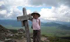
We paused to take a water-logged picture at the Garfield Ridge Trail sign.

Then we ambled along to Galehead Hut.

We were super-early and had our choice of the bunks. We dropped most of our gear and headed back out to tag Galehead.


A short and rainy half mile later, we were at the (very unremarkable) summit.

Spent the rest of the day relaxing at the hut and chatting with a few AT thru-hikers.
**************************************************************************
Day Two: South Twin and North Twin, then to Guyot Campsite.
Twinway, North Twin Spur, Twinway, Bondcliff Trail
6 miles.
The next morning was foggy, but the forecast promised sunshine. Stepping out on the porch of Galehead Hut, we could actually see something other than cloud.

Galehead Mountain from the hut (couldn't see it yesterday!)..

Off we set for South Twin.

Up the Twinway from the hut...a very steep 0.8 miles!! However, the sun was finally out and that made the never-ending climb a bit more bearable.

We were hoping for views at the summit, but alas, the sun hadn't burned off the clouds just yet.

Off we set for North Twin. Along the way, Alex snapped this picture...

Made it to North Twin with no problems. Went to check out the view...

...we dropped our packs at the cairn...

...and admired the fog.

Back to South Twin we went...

...noting some trillium along the way...

...to find an unfortunate lack of views at South Twin. We had lots of fog and blowing cloud instead.
After a lunch break, we continued along the Twinway toward Bondcliff Trail.


The 2 mile jaunt over to Bondcliff Trail was fairly flat, and very green. Upon approaching the intersection, we emerged from the trees and scrub and saw...
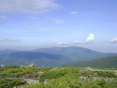
The clouds were starting to burn off now. We enjoyed the views as we reached Bondcliff Trail.
Five minutes later, we were on Mt. Guyot.
We crossed paths with a nice family, who offered to take our picture.
We rested up a bit, then continued on to Guyot Campsite.
The spur path to the actual site is mighty steep!
We checked in with Ryan, the caretaker (super nice and very informative!), and were able to secure a tent platform for the next two nights.
Here's the shelter (which we did not use)...
...and here's our tent platform.
We were both very tired at this point, so we set up the tent, cooked dinner (my JetBoil worked great!), and went to sleep.
**********************************************
Day 3 -- the Bonds.
Bondcliff Trail and West Bond Spur.
About 4.6 miles.
Eleven hours of sleep later, we were rarin' to go. We had our breakfast, then set off for the Bonds.
We decided to tackle West Bond first.
The summit is an easy half mile from the above intersection. It was a bright, sunny day with no wind whatsoever. The views were phenomenal.
Mt. Bond was next. Again, spectacular views.
Alex saw a bee on the summit cairn, and took an interest in it. She decided to take this picture.
I took a lot more pictures after our return from Bondcliff...those are posted later, below.
On toward Bondcliff...
Along the way we passed Ryan, who was out doing trailwork. We thanked him for all his hard efforts and chatted for a bit, then continued on our way.
We reached the top and touched all the high points. Alex is standing on what we think is the tallest rock.
Couldn't resist getting one with the famous cliffs.
Here's a shot from the top of that cliff.
Looking back toward Mt. Bond...
...and West Bond...
After a hearty snack, we began our trek back to Mt. Bond. Halfway along, I turned and got another shot of the cliffs.
Up, up, up we went...
Once back on Mt. Bond, I took a slew of photos...here are the Presidentials...
...Franconia Ridge...
...South Kinsman, and Moosilauke way in the distance...
and Carrigain.
A trail runner named Patrick was there, he helped pick out all the mountains for me. Thanks, Patrick. By the way, this fellow was in amazing shape. It was barely noon and he had almost finished a Pemi Loop. He looked as though he had just gotten out of bed and taken a shower. Amazing.
From here, Alex and I went back to camp. We spent the afternoon and early evening playing cards and resting at the campsite. We had an early dinner, and went to bed.
**************************************
Day Four: Zealand, and Zealand Trail trailhead.
Bondcliff Trail, Twinway, Lend-A-Hand Trail, Zealand Trail.
7.1 miles
Twelve hours of sleep later, we got up and packed the tent. The forecast (which Guyot Campsite receives) called for possible afternoon thunderstorms, so I wanted to get moving.
We said our farewells and gave our thanks to Ryan, then headed back up to Mt. Guyot. This time around, there were much better views.
We reached the intersection with the Twinway in short order, and headed over toward Zealand Mountain.
The path was mostly downward, save for a few tenths of a mile after the Guyot-Zealand col. We reached the spur path, and then the gorgeous peak of Zealand.
The day was bright and cool. It was fine walking, since almost all of it was down. We noticed nature's odds and ends, such as this tree.
We both felt fine and happy. Alex skipped along, in her usual descent mode.
The path became quite muddy close to Zeacliff -- the bog bridges were useful.
We came to the "view" sign for Zeacliff. We went to check it out...
A nice group of folks were there, hanging out. One of the men offered to take our picture.
Alex took a couple of shots herself.
There was a lovely breeze blowing. We took off our packs and rested for half an hour, chatting with the other hikers. A nice lady named Mina allowed Alex to pet her very friendly dogs, Shadow and Brandy. We had a great time, just chilling out, near the end of our long hike. Eventually we all decided it was time to move on. We said our goodbyes and went our seperate ways.
From here it's 1.2 miles to Zealand Falls Hut. About halfway down..oops..I slipped on a rock. I caught myself with my hand...peeled a bit of skin off my wrist and then discovered that my hand no longer worked quite so well. I sat there, all excited to use my WFA skills and splint myself...and then I realized that I had packed all my first aid stuff in the middle of my pack. Why, I've no idea. Note to self -- keep the bandages within easy reach!
I decided the psychological pain of unpacking my gigantic pack in the middle of the trail, and then putting it all back in again, far outweighed the physical pain of an unsplinted wrist. We were less than half a mile from the hut anyway. I took the three bandanas that I keep tied to the outside of our packs and quickly fashioned a make-shift wrap. Not perfect, but good enough.
We reached the hut...
...and Alex took a break on the porch...
...while I went in, disinfected my bloody wrist, and rewrapped my hand a bit more tightly.
When I came back outside, I found that Alex had made friends with a family of dayhikers. We hung out with them by the Falls for a while.
Alex's new friend, Jonah, offered to take our picture.
We all hiked down the trail together, Alex and Jonah in the lead.
After the inital steep bit, the trail flattens out and becomes a beautiful, winding path through and over beaver ponds. It was gorgeous. I think I'm going to take Sage on this one in the very near future.
Jonah's little sister, Francis, took a liking to Alex.
Here's one of the ponds...
Before we knew it, we had reached the trailhead!
This was a fantastic trip. We met so many kind and wonderful folks -- at the huts, on each of the trails, and at the campsite. Hikers are the best people!!
This brings us to 43.
5 more to go!




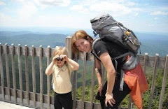

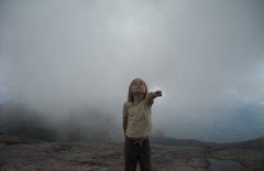


I am so impressed! My friend Bill (as in, Sheep the Dog's person) told me about you two and I've been enjoying the blog very much. What a lucky mom and child you are, to have so much fun exploring and hiking together!
ReplyDeleteKarin (two gerbils, no dog)
Thanks, Karin! We do have a good time.
ReplyDeleteWhen will we get to meet you out there on the trail? Do you ever hike with Bill and Sheep (both of whom I've had the lucky pleasure of meeting, on top of Mt. Lincoln)?