Ammonoosuc Ravine Trail, Crawford Path, Mt. Monroe Loop, Crawford Path, Gulfside Trail, Jewell Trail. (Overnight at Lakes of the Clouds)
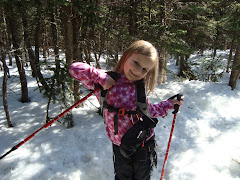
Hugh drove Alex and I to the Ammonoosuc Ravine Trail bright and early. The plan was for Alex and I to hike up to Lakes of the Clouds while Hugh and Sage took the Auto Road to Washington's summit. Hugh and Sage would then hike down to Lakes, where we'd all spend the night together.

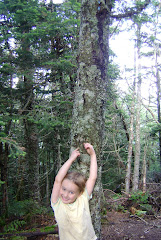
The first mile was practically flat throughout. Just a slight rise that was barely noticeable.


We came to this sign at the 1 mile mark. A trail branches off here toward the Cog Railroad, a rig that takes tourists up Mt. Washington.

From here the trail changed to a grade that was slightly more difficult. Still felt like a Sunday walk, though. Very beautiful, and it followed the Ammonoosuc River.
Beaver dam, perhaps..?

Lovely walk by the river, just beautiful...

We then came to Gem Pool, a lovely bit of water at the bottom of a scenic waterfall. A passing group of hikers offered to take our picture.

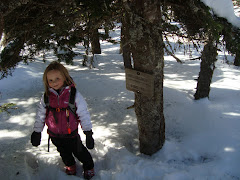
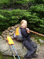
Here we stopped and rested. We knew the easy part was over, and that we had one mile of hard, steep hiking before we reached the hut. So we relaxed here a bit before moving on.

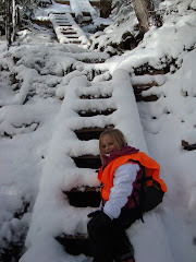
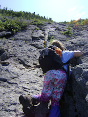
Now the fun part began.

Up, up, up.

The rock-steps changed into rock slabs. Here's a section we climbed, from the top looking down.

Water tricked and fell down neighboring rock slabs as we continued our journey upward.


We crossed the water...

then kept going up!


Hugh and I began our radio contact around this point. Before our trip, some wonderful people at the Mt. Washington Observatory Forums suggested we buy a family radio system. Cell phones don't work in most of the Whites, but radio systems will. This was a wonderful idea, it enabled Hugh and I to keep in contact with each other while separated.
He informed me that he and Sage were coming down the summit cone of Washington, and that Sage was hiking on her own two feet. I told him approximately where we were, and we continued onward.
Ah...almost there!

A bit more of a steep climb...

Then at last, some fairly flat bits! Allllmost there.

A VERY short bit of hiking later, and we could see the top of the hut!

Today's most difficult bit of hiking was now behind us.

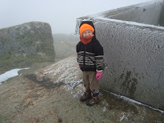
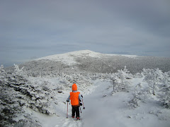
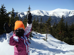
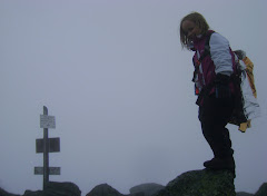
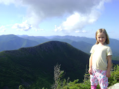
From this exact spot, here's Mt. Monroe:

And on the other side of the hut, Mt. Washington:

We jogged up to the end of the Ammonoosuc, then walked around to the front of the hut.


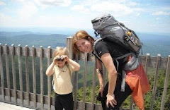
We then walked to the side facing Washington, and took a rest. We took some pictures while waiting for Hugh and Sage (the first one is my shot, the last three are Alex's).


We then went inside and claimed our bunks for the night.

Back outside we went, where we waited for Hugh and Sage. A short while later, we could see them coming toward us on the Crawford Path.

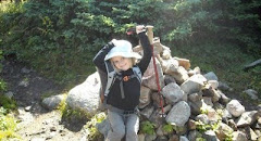
We reunited, and Hugh told us that he had only carried Sage about 100 feet. She had hiked almost the whole 1.5 miles on her own (her choice). Pretty impressive for a three year old!
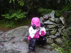
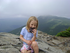
We went inside the hut and had cocoa. Some time later, Alex and Sage began to display loud examples of sibling rivalry...so I decided Alex and I should leave to summit Monroe (Sage declared she didn't want to hike anymore that day).


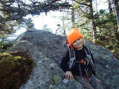
From here it was a relatively short rock scramble to Monroe's summit. We had left our packs at Lakes, so the hike was easy.
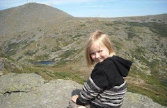
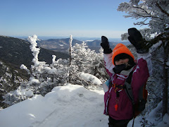
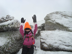
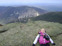
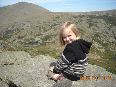
On Monroe's summit, with Washington in the background:
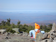
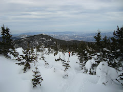
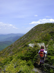
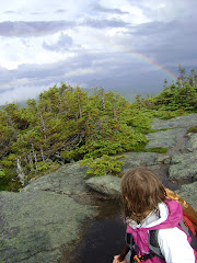
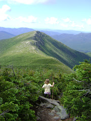
Looking south, we could see the Crawford Path winding its way over the southern Presidentials.

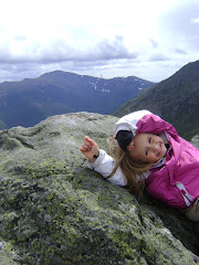
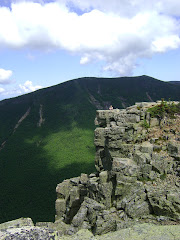
To the east, directly beneath Monroe's summit cone...
Coming down from the summit back toward the hut, one is afforded this lovely view...

We descended, and Hugh took his turn climbing Monroe while I stayed with the kids. I borrowed a few books from the hut's library and read outside until Hugh returned. I then got the kids clean and ready for the next day, figuring they could sleep in tomorrow's hiking clothes. After that, it was time for dinner.
Dinner was a delicious and fulfilling four course meal, served family style by the jovial "croo." After filling our tummies with warm yummy food, we sat just outside the hut and caught the sunset.

Then, off to bed.
At this particular hut, you share a large bunkroom with many other people, so I didn't get much sleep that night. I brought earplugs, but I don't like to use them since I like to keep an ear out for the girls. There were at least three men snoring loudly, and two kids (one of them mine) kept sleeptalking. So for me, it was a long night. Luckily, the girls slept soundly all the way through. Hugh slept fairly well too, but not as soundly as the girls.
Next morning, we ate another fulfilling, huge meal. Then -- off we set on the Crawford Path for the summit of Mount Washington.

Thirty steps down the path -- wham! Alex trips and slams her knee. Not the same knee she had slammed on Jefferson, thank goodness. She sat there for a while and Hugh and I assessed the potential damage. We both agreed nothing seemed broken, so I told Hugh and Sage to go ahead and we would eventually catch up with them. We turned on our radios, and off they went.
I sat with Alex for a while, waiting for her to feel okay enough to move on. When we set out again, it was at a slow pace and she limped a bit. After about five minutes, however, she took her usual strong stride and said it no longer bothered her. She hiked the rest of the day without a trace of pain or limp, so I guess it was "just" a bruising.
Not far from the hut, there are two lakes (hence the name Lakes of the Clouds). The Crawford Path winds between them.


After going around the lakes, we were faced with a rocky path toward the summit cone.

We passed Hugh and Sage, and agreed that we would go on ahead and meet them at the top. Sage was still walking on her own at this point.
Onward we travelled, to the summit cone and upward. Looking back, we could see Lakes of the Clouds with Mt. Monroe in the background.

Up the summit cone:

Soon there!

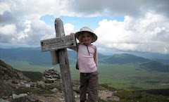
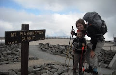
We reached the Crawford Path sign near the summit.

From here, it's a short jaunt to the final pile of summit rocks..

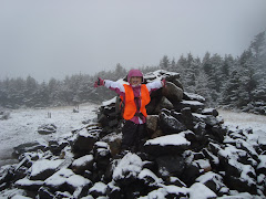
And we're there!

We descended to the summit building where one can catch the Hiker's Shuttle. I tried to buy a ticket for Hugh and Sage, but was informed they would have to be physically present and purchase the ticket for themselves. We went back to the top of the Crawford Path and waited for them. While we waited, we remarked to each other how easy that hike from Lakes seemed. It didn't take us nearly as long as we thought it would. The path itself is rocky, but the footing is very good. We both felt fine and psyched for the hike down.
Not much time passed before we saw Hugh and Sage come up over the cone. Hugh told me later that he had ended up carrying Sage most of the way (as we suspected would happen...she's strong, but she's still only three years old).
Here they come...

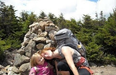
Alex and Sage were giggling madly at this point. They both ran full speed toward each other and knocked themselves over.


Alex and I walked with Hugh and Sage to the summit.

Hugh and Sage secured their ticket with the Hiker's Shuttle, then went into the TipTop House while Alex and I checked out the Observatory.

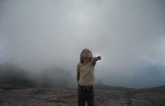
A cloud had rolled in, so we didn't bother trying to get good pictures from the summit. We weren't complaining though -- we'd had 30 mile visibility and little winds the entire trip up to this point.
We heard Hugh and Sage calling out to us -- their shuttle was leaving for the auto road descent. We bade our farewells and wished them a good ride.
After we parted with Hugh and Sage, Alex and I filled our water bottles inside one of the summit buildings. We also checked the forecast at the information desk. There was a nifty computer radar image. The lady at the desk said we might get a little rain on the way down, but there was no electrical activity visible. I told her we were going down the Jewell trail, a very exposed path. She was unconcerned about the possibility of lightning. She did raise an eyebrow at Alex, however. Alex's head did not clear the counter -- she was standing on her tiptoes trying to see the lady behind the desk. The lady asked Alex if she had ever hiked that far before, then she gave me a penetrating glance. I assured her we were fine. We signed the hiker registration book ("Trish and Alex!") and went back outside to find the Gulfside Trail (which would take us to the Jewell Trail).
After a bit of confusion, I found the sign (near the summit), and the "Trinity Heights Connector" post.


Now began the really difficult part of our entire hike, at least for me. The trip down the summit cone was a jumble of large, loose rocks, casually marked with cairns.

We made our way down off the cone and continued to follow the Gulfside Trail, crossing the Cog Railroad tracks as we went.

Just after we crossed the tracks, we came to the intersection with the Great Gulf Trail. We heard a train coming, so we sat, drank water, and watched it pass.
Here's a reason I don't particularly care for the Cog:

The passengers inside this particular train, however, seemed rather nice (if you zoom in, you can see some folks waving at us).

As we continued down the Gulfside Trail, the clouds begain to clear a bit, opening up views into the valleys below.


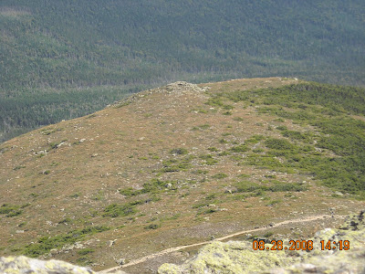
The Gulfside Trail winds around the west side of Mt. Clay. One could take a short hike up Clay, but Alex and I passed. We were just in the mood to continue our descent.

After what seemed like an eternity of rock-hopping, we reached the Jewell Trail.

More, more, more rock-hopping. At this point, I was really, truly ready for some semblance of a smooth trail.
After a million years, the trail became a little less rocky.

Looking down, we could see the Cog parking lot (big white spot in valley)-- the trailhead is a couple tenths of a mile to the west of that. That's where we were headed, a little over 3 miles from the above photo.

We came to the treeline -- and hooray! Dirt path, extremely moderate/easy grade. This was a welcome relief to our feet.

Just under 3 miles to go now, all of it easy/moderate with very good footing.
At one point, we were able to look back through the trees at Mt. Washington.

Some more nice trail, a footbridge over a water crossing..

...more easy trail after that, and soon we were at the intersection with the Boundary Line Trail.

One mile to go! I radioed Hugh and told him we were soon there (he and Sage were now waiting near the trailhead in the car).
One more footbridge over a nice little brook..

Then a bit more flat easy trail, and we're there!

Hugh and Sage were waiting. Alex and I piled into the car, and we all rode back home. One happy, smelly bunch.